Hey everyone!
It’s officially summer and I don’t know about you but I can’t wait! Have you checked out our Summer Bucket List? If not, take a look. Lot’s of adventures and many are absolutely free!

This first appeared in the Up & Adams Newsletter -- sign up for it here!
Of course, summer fun can be quite dependent on the weather. And so far severe weather season has gotten off to a quick start with our first tornado of the year occurring on June 15.
Storms got fired up out to our west in the late afternoon due to an area of low pressure with favorable upper level dynamics. I started tracking on Exact Track 4D Radar around 2 p.m., and continued to watch the storms intensify as they moved east.
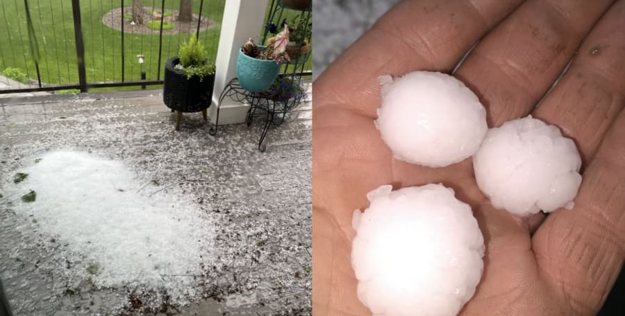
Hail quickly became the primary severe weather threat with reports of 1 inch hail (about the size of a quarter) in Howell and Pinckney. Although large hail does not always mean a tornado will occur, it is a sign of strong updrafts and that makes our ears perk up as meteorologists.

I turned on our wind sheer marker and monitored the velocity. With multiple severe thunderstorm warnings between 5-6pm, our radar began to pick up signs of rotation in a cell down to our south in extreme eastern Monroe County near Dixie Hwy. This cell was approaching Detroit Beach minutes after 6pm and our radar showed rotation before the Tornado Warning was issued. (See the radar image at the top!)
At 6:09 the tornado touched down and tracked east-northeast through Woodland Beach.
According to the National Weather Service winds reached 90mph, which is an EF1 on the Enhanced Fujita Scale, and had a width of 400 yards (.22 miles). Large trees were down and damage to several residences were reported from Detroit Beach up to Estral Beach. The tornado lasted 9 minutes from touchdown to liftoff and cut a path length of 4.7 miles.
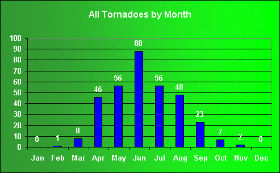
Since 1950 331 tornadoes have hit Southeast Lower Michigan, killing 166 people. Tornado season peaks in June for Metro Detroit. Here are a couple of charts from the National Weather Service:


🌧️ Connect with 4Warn Weather
Track the weather with us daily with the 4Warn Weather app, available for free on your mobile device. You can get alerts on your local weather, as well as updates from the 4Warn Weather team, and severe weather warnings and watches from the area. You can also follow live radar, wherever you are!
You can also track the latest on the ClickOnDetroit weather page right here.
Until next time,
- Kim Adams, 4Warn Weather (Email me here if you have a question or want to say hello)


