DETROIT – Here is the Metro Detroit weather forecast update for Feb. 16, 2022, afternoon and evening.
Rain rest of Wednesday
Recommended Videos
- Rain is moving in Wednesday afternoon, becoming heavy at times Wednesday night.
- This rain should change over to a wintry mix/freezing rain around daybreak Thursday.
- Rain totals will range from over half an inch near I-69 to over an inch in our South Zone.
Wintry mess/snow Thursday
- Models are following our lead from the last couple of days and giving way to more snow for us later Thursday.
- In the morning, the temperature profile will be appropriate for areas in the Metro and South zones to see some freezing rain. These areas could see up to a tenth of an inch of ice, which could cause issues in the morning.
- After a quick break in the action, snow moves in during the afternoon and evening Thursday. It will wrap up around midnight.
- This snow will be heavy, at times. By the time all is said and done, a solid 3-7 inches can be expected across the area. Highest snow totals will be through Lenawee, Washtenaw, southern Oakland and western Wayne counties.
Watches, warnings and advisories
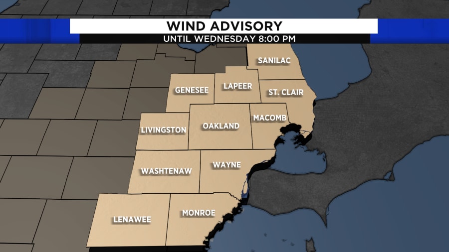
- A wind advisory is in effect for all of Southeast Michigan through 8 p.m. Wednesday.

- A flood watch is in effect for Lenawee, Macomb, Monroe, Oakland, St. Clair, Washtenaw and Wayne from 4 a.m. to 4 p.m. Thursday.

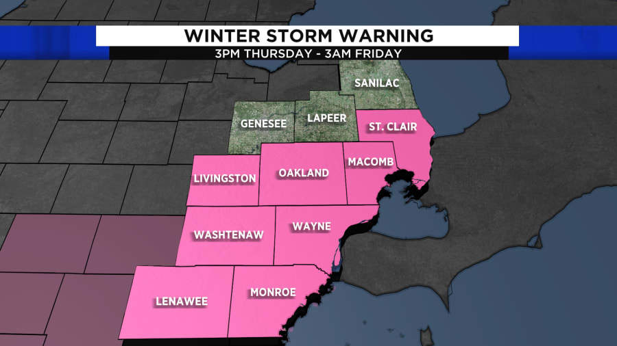
- A winter storm warning is in effect for all of Southeast Michigan from 3 p.m. Thursday to 3 a.m. Friday.

More light snow Friday night/Saturday morning
- Another quick-moving system will bring us some light snow Friday night into Saturday morning.
- This will likely give way to another half-inch of snow accumulation.


