4Warn Weather – Metro Detroit is expected to get a mixture of freezing rain, snow, and rain over the next several hours and days.
Here’s a breakdown of what to expect:
Recommended Videos
Wintry mess rest of Wednesday
On Wednesday afternoon, we’ll see freezing rain continue to be the dominant impact weather-wise.
As we get closer to 6 p.m., the South Zone will see more of a rain takeover. This may creep as far north as I-96 and will continue until about 9 p.m.
After 9 p.m., and until around midnight, most areas will see freezing rain as again the dominant weather feature. South Zone may hang on to some plain old rain.
All precipitation shuts off around midnight.
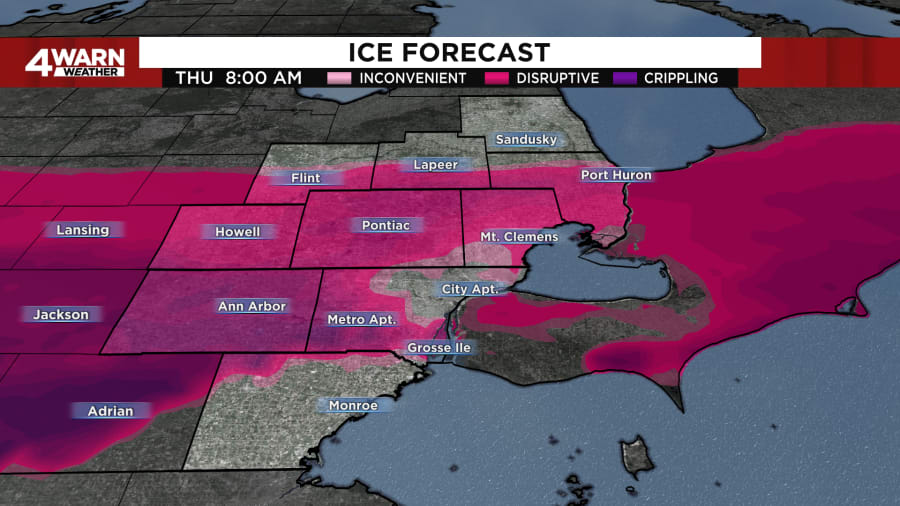
Ice accumulation continues to be the biggest threat. The biggest impacts will be felt in Washtenaw, Livingston, southern Oakland, and western Wayne counties, where near a half-inch of ice (for the most part) will be possible.

Areas south of I-69 could see a couple tenths of an inch of ice to near a half-inch near M-59. Areas south of I-94 could see a half-inch to a trace near the Ohio border.
Snow accumulation continues to look best north of I-69, where multiple inches are likely. In Southeast Michigan, anyone north of I-94 could see a few tenths of an inch of snow to near 2 inches near I-69.
Light mix possible Thursday
We’re not anticipating much of an impact from this, but a snowflake or two may mix in with a cold raindrop from time to time Thursday.
The best chances for this will be mainly in the North Zone, but impacts should be minimal.
Colder with less snow this weekend
On the back side of this system, colder air moves in Friday.
Highs will only be in the 20s, but it’s going to feel like the teens with gusty winds around.
With the flow off the lakes, a few snowflakes will be possible during the day Friday, but it’s overnight into early Saturday that a weak disturbance brings us a few light snow showers. This could lead to a light accumulation, perhaps up to an inch.
Rain, snow next week
Long-range models have been consistent in bringing us rain later Monday.
On the back side of that system, some light snow is looking likely Tuesday, mainly in the morning.


