4Warn Weather – It has been a nice and warm week across Southeastern Michigan with plenty of sunshine and well above average temperatures, especially toward the end of the week.
But looking ahead into the next few weeks, it looks like some cooler changes are heading our way -- though not major changes, like we saw at the end of April with chilly temperatures.
Southeastern Michigan forecast for next few weeks
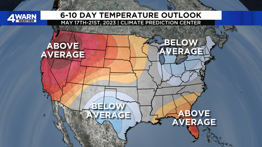
6-10 Day temperature outlook: Below average trend for temperatures

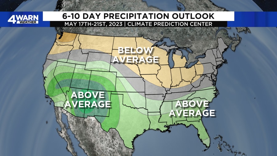
6-10 Day precipitation outlook: Below average trend for precipitation

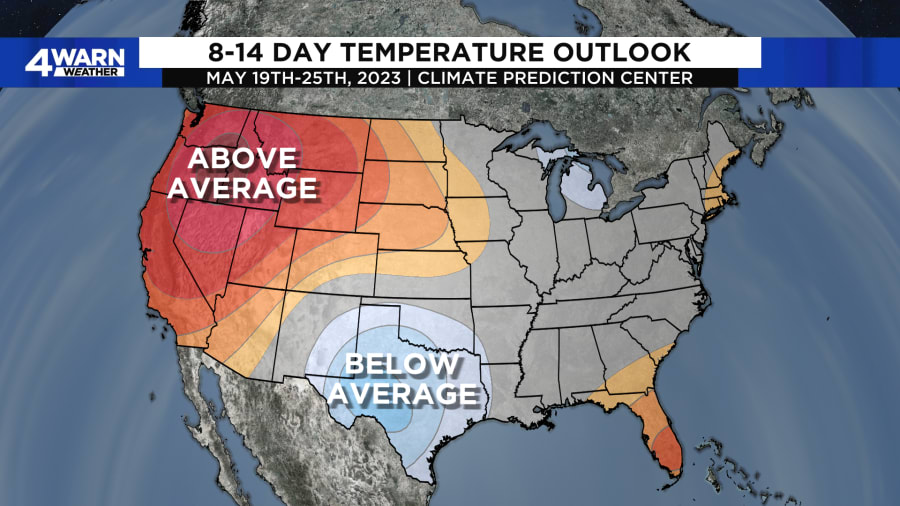
8-14 Day temperature outlook: Near/slightly below average trend for temperatures

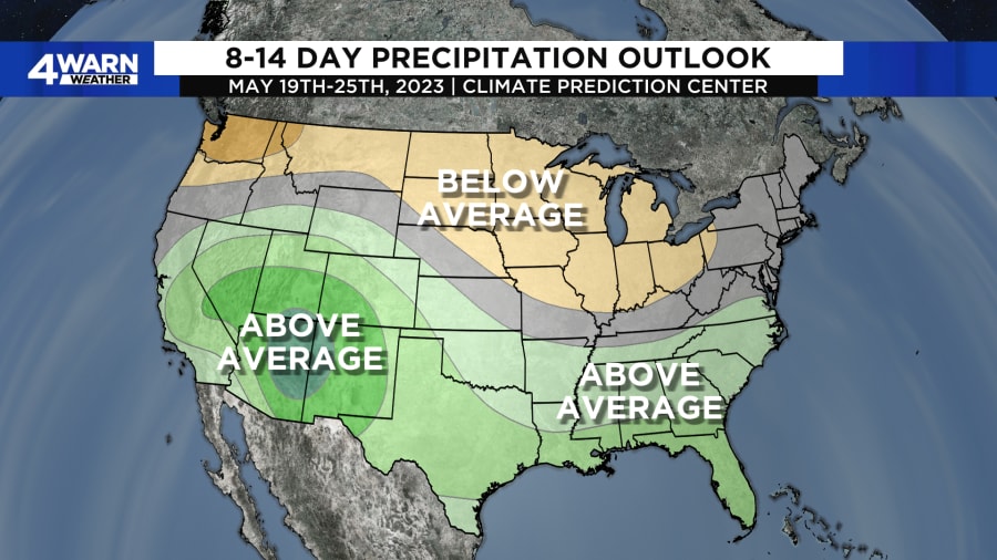
8-14 Day precipitation outlook: Below average trend for precipitation

How does this play into our forecast?
During the next few weeks, our average high temperature is between 71-73 degrees, with overnight lows averaging in the lower 50s.
With this current forecast, we would expect that temperatures would be into the upper 60s to lower 70s during the next few weeks, with overnight lows in the 40s to lower 50s, since we are trending slightly below to below average. Keep in mind, this is the longer-range trend, so we could see some spikes in this going above average for a few days, but the overall trend is slightly below to below average.
If you think “this means we are getting cold again,” the answer to that would be: not necessarily.
With our average high temperatures now into the 70s, even if we are a degree or two below that for our daytime high, that would qualify as “below average”. And remember, when we had those chilly temperatures, we had the darker blues in the long-range temperature forecast out for our region. This time, we are in the lighter blue, and even for the 8-14 day temperature outlook, some of us are near average, especially closer to the state line.
In terms of precipitation, if you’ve seen our latest forecasts this week, we have progressively removed rain from the forecast for Mother’s Day weekend to make most of it dry, with just a few chances for showers. It looks like that drier trend will continue into the next few weeks with Southeastern Michigan trending drier than we should be.
This is because the general storm track over the next few weeks is forecast to favor the Central and Southern United States, as we are seeing right now with the latest low-pressure system tracking south of the region taking any decent chances of rainfall with it. This would support the outlook from the Climate Prediction Center keeping the northern Great Lakes including Michigan in the below average trend for precipitation.
Of course, we will continue to fine tune this forecast as we head into next week, but overall, we are not seeing any major signs of any major cooldowns. So, if you are thinking about putting those flowers/plants into the ground now for gardening, it looks like we would be safe to get some of those annuals or perennials ready to be planted!


