Southeast Michigan was under a severe thunderstorm watch on Wednesday with potentially hazardous weather expected to arrive in the afternoon.
A weather system was set to move across Metro Detroit on Wednesday, April 17. The potentially severe thunderstorms could bring hazardous winds, large hail, minor flooding, and the chance of an isolated tornado to the area.
The National Weather Service issued a severe thunderstorm watch for Southeast Michigan until 7 p.m. Wednesday due to the storms. The watch was in effect for the entire region, including Wayne, Macomb, Oakland, Washtenaw, Monroe, Livingston, Lenawee, Lapeer, St. Clair, Sanilac, and Genesee counties.
What’s a severe thunderstorm watch?
The NWS issues a severe thunderstorm watch for an area when severe thunderstorms are possible there. The alert is meant to encourage people to prepare for potentially severe weather.
Severe thunderstorms were particularly possible in Southeast Michigan between 2 p.m. and 7 p.m. on Wednesday.
What hazards are expected?
On Wednesday, April 17, much of Southeast Michigan was at a slight risk (level 2 of 5) for severe weather. Communities near the Thumb region were at a marginal risk (level 1 of 5) for severe weather.
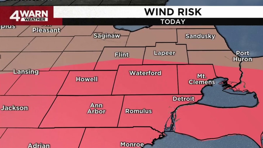
Strong wind gusts were expected to be the most prominent threat on Wednesday. Wind gusts could reach 70 mph.
The area colored red on the map below was expected to be most impacted by wind.

Power outages are a particular concern as strong winds can impact power lines.
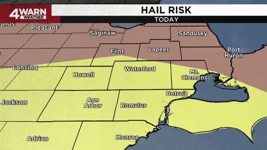
Scattered hail was also a possibility on Wednesday. The hail could be large, reaching an inch in diameter. The area colored yellow below was expected to be most impacted by hail.

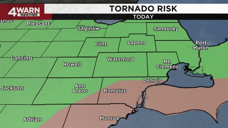
There was also a chance of tornadoes in Southeast Michigan on Wednesday.
The area colored brown on the map below were at about a 5% risk of experiencing tornadoes, which the NWS says is a “low” chance -- though a chance still exists. The area colored green was also at a risk, though lower at about 2% -- which the NWS considers to be “very low.”

Learn more about tornado threats from the NWS here.
Minor, localized flooding was also a possibility on Wednesday, though the risk was lower than the other possible hazards.
What’s a severe thunderstorm warning?
A severe thunderstorm warning is a step up from a severe thunderstorm watch.
The NWS issues this warning when severe weather is actually active and has been reported or is visible by radar. Warnings from the NWS typically indicate that there is danger present due to the weather.
When severe thunderstorm warnings are issued, the NWS says there is “imminent danger to life and property.” People are urged to take shelter in stable buildings when this warning is issued.
A severe thunderstorm warning was not issued for Southeast Michigan on Wednesday.

