

The hot, humid, and stormy weather will continue over the next few days.
Flood woes will also continue near Hamburg and neighboring communities. A flood warning remains in effect for the Huron River in Livingston County for the forecast of moderate flooding. The river had exceeded 7.5 feet on Saturday evening, which is above the flood stage of 7 feet. It is forecast to crest overnight at 7.7 feet, which will lead to more property damage.
Saturday night will be warm and partly cloudy before the chance of showers and thunderstorms return early Sunday. Temperatures will fall to the upper 60s during the predawn hours of Sunday.
Sunday
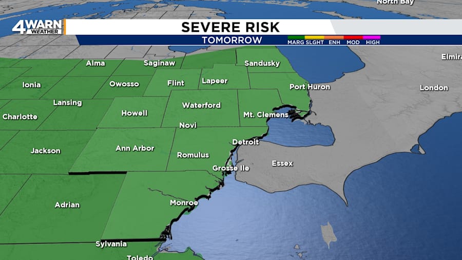
Showers and thunderstorms are forecast to start moving into Southeast Michigan from the west after 8 a.m. Sunday. A midday break in action is likely before more storms develop in the evening. A couple of the storms could become strong to severe during the morning and evening with a marginal (level one of five) risk over all of Metro Detroit and northward to Saginaw. The primary threat is gusty winds, but hail and an isolated tornado are also possible.
Sunday’s highs will be in the upper 80s in Metro Detroit, while temperatures will top out in the mid 80s north of M-59. The high humidity will contribute to afternoon heat indices from 90 to 95 degrees. Non-thunderstorm winds will be out of the southwest at 8 to 15 mph with gusts up to 25 mph.
Sunday night, it will be partly cloudy with a chance of showers. Lows will be around 70 degrees.
Monday through weekend
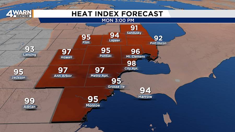
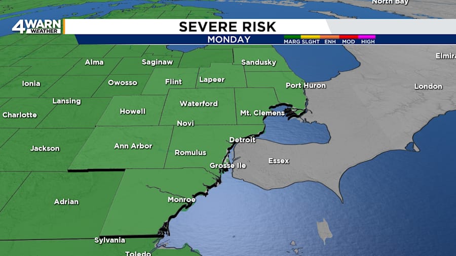
Both Monday and Tuesday will be hot and humid with temperatures in the mid 80s to 90 degrees. The heat index will reach the mid to upper 90s. Conditions will be favorable for showers and thunderstorms as two air masses collide near Southeast Michigan. A few storms could become strong with heavy rain and gusty winds.
A cold front will sweep across the area late Tuesday and offer relief with cooler and drier air on Wednesday. Highs will be in the mid 70s to the lower 80s into next weekend. Skies will be partly cloudy to mostly sunny as a high-pressure system drifts over the Great Lakes with calmer conditions.
