

4Warn Weather – There are flood concerns as severe storms move through Metro Detroit overnight.
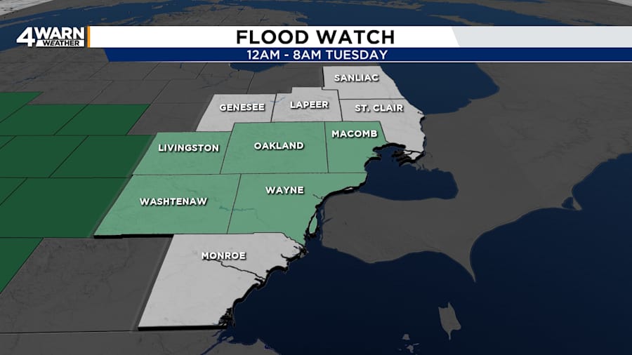
Flood Watch
At midnight, a flood watch went into effect for Livingston, Oakland, Macomb, Washtenaw, and Wayne counties due to the potential for excessive rain. This watch, which is scheduled to expire at 8 a.m. Tuesday, includes some communities that received heavy rain on Monday morning.
Flood Warning
A flood warning continues for the Huron River near Hamburg in Livingston County until further notice. Moderate flooding is already being observed, and additional heavy rain could cause further rise. Avoid walking or driving into floodwaters.
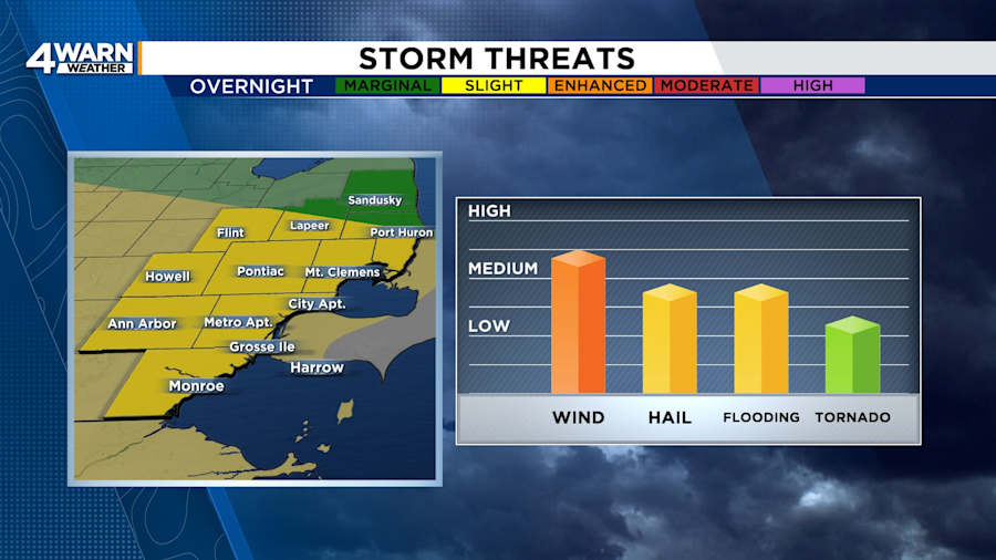
Storm Threat
The storms were expected to first impact communities west of US-23, mainly after 1 a.m. Tuesday. Then, they moved eastward across Southeast Michigan, threatening strong winds, hail, and torrential rain. The Storm Prediction Center had blanketed most of Southeast Michigan under a slight (or level two of five) risk for severe weather.
Safety Tips and Reminders
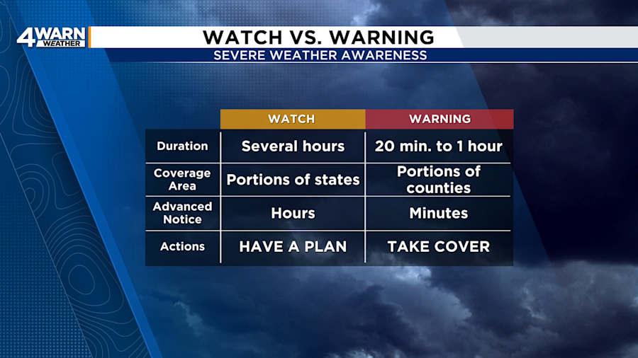
Have multiple ways to get alerts, such as the 4Warn Weather App and NOAA Weather Radio. A watch means that conditions are favorable for the warned weather event, while a warning means the warned conditions are happening or imminent. Always have a safety plan, and take action when a warning is issued. Remember, it is important to shelter for severe thunderstorm warnings. Straight-line winds can uproot trees or remove branches that can fall on homes and vehicles. Severe thunderstorms can also spin up tornadoes with little additional warning. The risk of an overnight tornado during this event is low, but an isolated tornado cannot be ruled out.
Tuesday
While the heaviest rain is expected to exit the region before rush hour, a few showers and thunderstorms may linger into the start of the morning commute. Localized street flooding could be an issue even after the rain has ended.
After the morning showers and thunderstorms, Tuesday will be mostly cloudy. However, a cold front will sweep across the area in the afternoon and early evening, bringing a chance of spotty showers and a few thunderstorms. Highs will be in the mid-80s around Detroit and the lower 80s north of M-59. Winds will be out of the west-southwest at 5 to 15 mph.
Tuesday night, skies will be partly cloudy with lows from 60 to 65 degrees. The warmer locations will surround Dearborn, Detroit, Ferndale, and Warren.
Wednesday
Behind the cold front, the cooler and drier air will offer relief on Wednesday. Highs will be near 80 degrees under partly cloudy skies. A stray shower will be possible, but most places will remain dry. Lows will be in the mid to upper 50s.
Through the Weekend
Through the weekend, highs will be in the mid-70s to the lower 80s, with mostly sunny to partly cloudy skies.
Remember to download the free 4Warn weather app -- it’s easily one of the best in the nation. Just search your app store under WDIV and it’s right there available for both iPhones and Androids! Or click the appropriate link below.


