

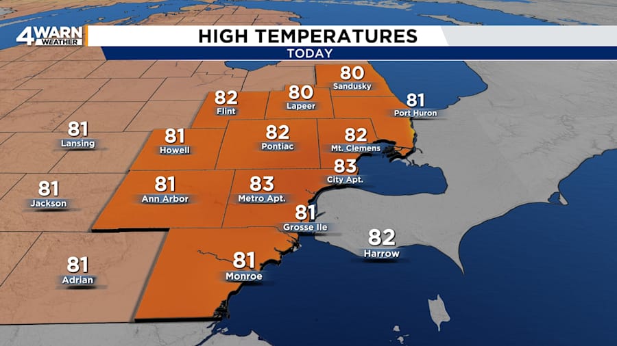
We have another warm day with a decent amount of sunshine as we begin the weekend in Metro Detroit.
A high-pressure system is dominating the weather conditions over the Great Lakes region. With mostly sunny to partly cloudy skies, highs will be in the lower 80s on Saturday afternoon across Southeast Michigan. It will be a great day to go to the Ann Arbor Art Fair or the Riverfront Music Festival at Detroit’s Hart Plaza.
Saturday night will be partly cloudy with lows in the lower 60s. Expect light westerly winds.
Sunday
A cold front will sag across the area and push southward on Sunday. Clouds will increase and skies become mostly cloudy by midday. The afternoon highs will be in the lower 80s. Winds will be out of the northwest around 5 mph.
Monday
Monday will also bring mostly cloudy conditions. Highs will be in the mid 80s and lows in the lower to mid 60s.
The next best chances of rain showers will be Tuesday through Thursday with highs forecast to be in the lower to mid 80s.
Despite the calm weather, a flood warning continues for the Huron River in Livingston County until early Sunday morning. Minor flooding was still being observed on Saturday morning with a stage of 7.2 feet. The river is expected to fall below the flood stage of 7 feet on Saturday evening.
