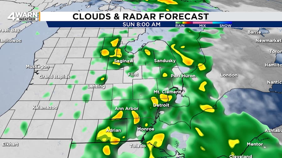
Temperatures will be above normal for the entire holiday in Metro Detroit. Rain showers will impact Southeast Michigan for part of the weekend.
Saturday night will be mostly cloudy with the chance of a few showers. The chance of showers will increase overnight. Lows will range from 40 to 45 degrees with the warmer temperatures in Detroit, Monroe, and Downriver.
Sunday
Showers will move into Southeast Michigan from the southwest early Sunday. The best chance of showers will be from 6 a.m. to noon. A few showers will be possible through the evening. Otherwise, it will be mostly cloudy. Expect highs around 60 degrees, which is about 10 degrees above normal. Winds will be out of the south and southwest at 5-15 mph with gusts up to 25 mph.

Sunday night, it will be mostly cloudy with the chance of a couple of isolated showers. Lows will be in the mid 40s.
Veterans Day
Monday, or Veterans Day, it will be drier and breezy with a mix of sunshine and clouds. Westerly winds will be 10 to 15 mph with gusts up to 25 mph. Highs will be around 60 degrees, and lows will be in the lower to mid 30s.
Tuesday
Tuesday will be mostly sunny, but it will also be cooler. Highs will be back to normal at around 50 degrees. Lows will be in the lower to mid 30s.
Wednesday
Wednesday is likely to be dry until the nighttime hours. After daytime highs in the lower to mid 50s with partly cloudy to mostly cloudy skies, showers will arrive for the evening with lows in the lower 40s.
Thursday
A spotty shower will be left over for early Thursday. Otherwise, it will be mostly cloudy. Highs will be in the lower 50s.
Friday
Friday’s temperatures will be the same, but skies will become mostly sunny.
Tracking the Tropics
Internationally, Rafael was expected to continue to weaken in the Gulf of Mexico. It was forecast to become a depression by late Sunday or early Monday. Its path is also forecast to move away from the U.S. and toward Mexico in a southerly and southwesterly direction.


