December and meteorological winter are beginning with unusually cold weather in Metro Detroit.
After a high of 30 degrees on Sunday afternoon at Detroit Metro Airport, nighttime temperatures were forecast to tumble to the lower 20s. Westerly winds of 8 to 12 mph will push wind chills into the teens and single digits. Skies will range from partly cloudy to mostly cloudy with the chance of a few flurries.
Monday
Monday will bring a mix of sunshine and clouds in the morning. Skies will lean toward being mostly cloudy in the afternoon. Expect morning temperatures below freezing and wind chills in the teens and single digits. In the afternoon, highs will be around 35 degrees. Westerly winds will be 5 to 10 mph.
Monday night, skies will be partly to mostly cloudy. Lows will be in the lower 20s.
Tuesday
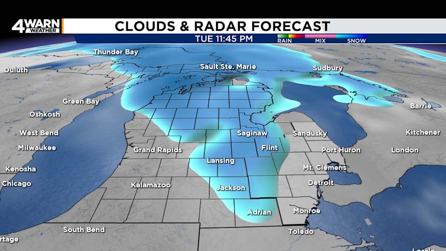
Tuesday will have a couple of daytime flurries as highs peak in the lower to mid 30s, but the chance of widespread snow will return at night. Lows will be in the mid to upper 20s.

Wednesday
Wednesday will be breezy and snowy as a system sweeps across the Great Lakes. Snow accumulation is possible. Afternoon highs in the mid 30s will allow some transition to rain. Lows will be in the lower 20s.
Thursday
A colder air mass will move over Southeast Michigan on Thursday. Lake-effect snow snow showers will try to make their way into the region. Highs will be in the lower 30s. Expect lows in the teens.
An arctic blast will usher in nighttime and early morning temperatures in the teens across the Great Lakes for the end of the workweek.
Welcome to winter... sort of
Dec. 1 marked the first day of meteorological winter, while astronomical winter will begin on Dec. 21. Meteorological seasons have the same start and end dates each year, which benefits seasonal recordkeeping.


