

4Warn Weather – Strong and slow-moving storms are leaving behind flooding in Southeast Michigan.
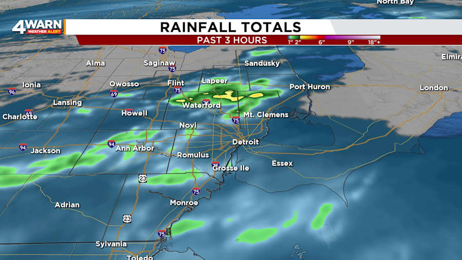
Flash Flood Warnings, which were in effect for southwestern Lapeer, northeastern Oakland, and northern Macomb counties were canceled as conditions improved.
A flash flood is a flood that occurs rapidly due to heavy rainfall in a short amount of time.
Although the warnings are no longer in effect, some streets, sidewalks and low-lying areas may still have standing water.
Thunderstorms produced heavy rain at rates of 1 to 3 inches per hour. Up to 3 inches of rain had fallen as of 7 p.m., and more rain was expected.
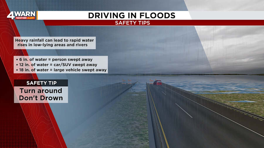
It is important to avoid walking or driving in floodwaters. The depth of water can be deceptive. Just a foot of moving water can move a vehicle.
It is always best to turn around and avoid a potentially dangerous situation. People should also avoid entering a flooded basement. Wait until the water has receded or the electricity has been disconnected.
Besides the chance of a couple of sprinkles overnight and early Saturday, the chance of heavy rain will come to an end Friday night.
Under mostly cloudy skies, lows will be 45 to 50 degrees, early Saturday morning.
A few sprinkles will be possible in the morning. Otherwise, clouds will decrease and give way to sunshine. It will be cool and breezy. Afternoon temperatures will be in the mid-50s. Winds will be out of the north-northwest at 10 to 15 mph with gusts up to 30 mph.
Saturday night will be partly cloudy to mostly clear. Lows will fall to around 40 degrees.
Sunday will be mostly sunny. Expect highs in the lower- to mid-60s. Lows will be in the mid-40s.
Daytime temperatures will return to the lower-70s on Monday and lower-80s on Tuesday, but the chance of showers and storms will also return on Tuesday.
Find the latest forecast from the 4Warn Weather team here
Remember to download the free 4Warn weather app -- it’s easily one of the best in the nation. Just search your app store under WDIV, and it’s right there, available for both iPhones and Androids! Or click the appropriate link below.


