

Metro Detroit is headed for a magnificent Monday, but Tuesday will bring warm, windy and rainy weather.
Sunday’s temperatures peaked in the mid-60s after early morning lows ranging from 30 to 40 degrees in Southeast Michigan.
Skies will be mostly clear on Sunday night, with lows in the lower-40s in Adrian, Howell, Fenton, Lapeer and Port Huron. Lows will be around 45 degrees in Livonia, Canton, Dearborn, Troy, Warren and Shelby Township. Winds will be out of the south-southeast at around 5 mph.
Monday
Under sunny skies, warmer air will flow into Southeast Michigan on Monday. Highs will reach the lower-70s, except for readings in the mid-60s near the Lake Huron shoreline. Southerly winds will be 6 to 12 mph with gusts up to 20 mph.
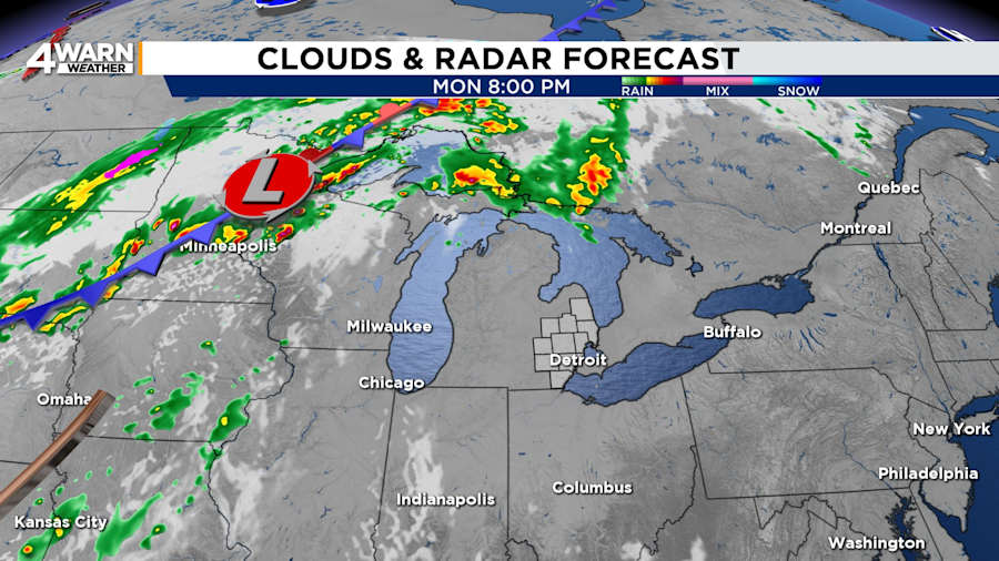
Clouds will increase on Monday night, with lows in the lower- to mid-60s.
Tuesday
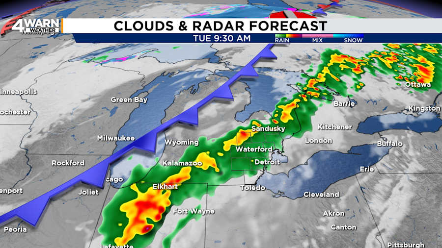
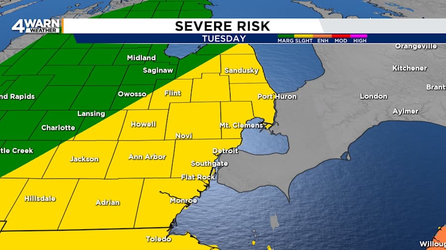
Tuesday will be warm, windy and rainy. Plan for the chance of showers and thunderstorms during the morning. A few more thunderstorms are likely to develop in the afternoon and early evening ahead of a cold.
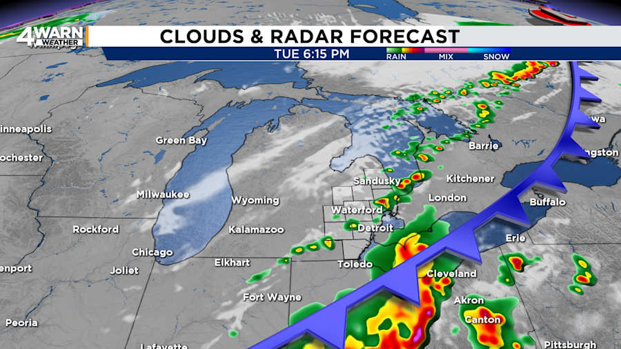
There is a low chance of these storms becoming intense. Southeast Michigan is under a slight, or level two of five, risk of severe thunderstorms.
Otherwise, it will be hot and breezy. Highs will be in the lower-80s. Winds will be out of the south-southwest at 15 to 25 mph and gusts up to 35 mph.
Tuesday night will be partly cloudy, with lows near 40 to 45 degrees.
Wednesday and Thursday
Wednesday and Thursday will see temperatures in the lower- to mid-60s. While Wednesday will be partly cloudy, Thursday will be mostly cloudy with the chance of rain showers.
Average highs in early May are in the mid-60s, and average lows are in the mid-40s.
