

Ready for the heat? Dust off your ceiling fans. Next week will be hot.
The rain showers moved out of Southeast Michigan just in time for Flag Day activities. Daytime temperatures rose to the 70s, with sunshine. Temperatures were expected to be in the 60s and 70s Saturday evening.
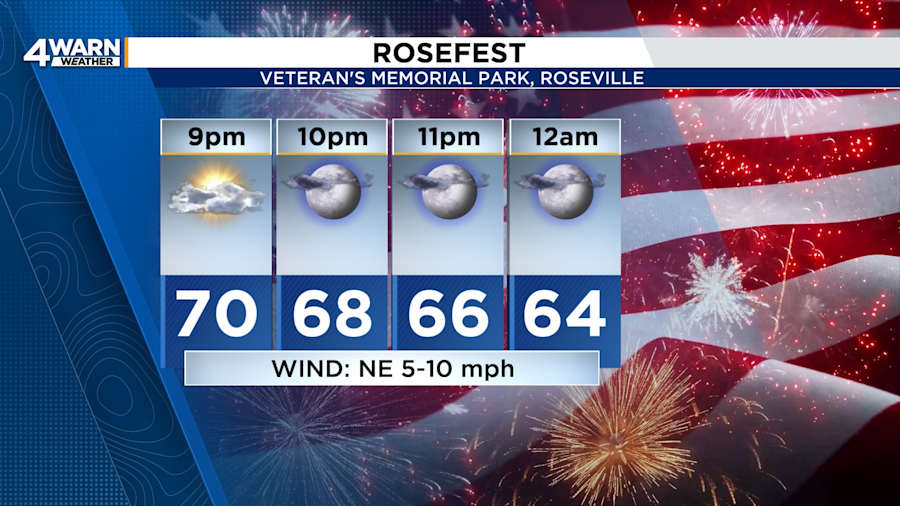
People will enjoy ideal weather for the Canton Liberty Fest or Redford Community Festival. Conditions will also be great for people attending the fireworks show at Roseville’s RoseFest.
Unlike Friday night’s wet weather, it will stay dry on Saturday night. Lows will be in the mid-50s. Northeasterly winds will be 5 to 10 mph.
Sunday
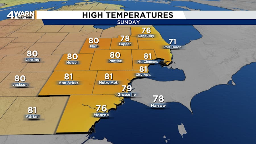
Sunday, or Father’s Day, will bring sunshine and warmer temperatures to Metro Detroit. Temperatures will peak around 80 degrees in the afternoon. Winds will be out of the east-northeast at 5 to 10 mph. Conditions will be great for getting on the water, fishing, hiking, jumping in the pool, playing outdoor sports, or going to a festival.
Under partly cloudy skies, Sunday night’s lows will be near 60 degrees.
Monday
Expect mostly sunny to partly cloudy skies on Monday. Highs will be in the lower-80s, and lows will be in the lower- to mid-60s.
Tuesday
The heat will reinforce itself over Southeast Michigan on Tuesday. The chance for rain showers and thunderstorms will re-enter the picture in the afternoon. Highs are likely to reach the mid-80s. Nighttime temperatures will only fall into the mid- to upper-60s.
Wednesday
Wednesday could become an active weather day. With highs in the mid-80s, the heat and moisture will contribute to storm development along and ahead of an approaching cold front. The ingredients for the risk of strong to severe storms will be in place. Lows will be in the mid-60s.
Looking Ahead
Temperature will be in the lower-80s to end the workweek, with rain chances on Thursday and Saturday.
The summer solstice will occur on Friday night, and it will feel like summer all week.
See interesting weather? Have photos of the fireworks?
Share your photos with Local 4 through MIPics.
