
4Warn Weather – After lots of sunshine and a few thunderstorms for some of us throughout our Thursday, we will keep the sunshine along with heat humidity, and the chance for a thunderstorm or two into the forecast looking ahead into our Friday.
Air Quality Alert
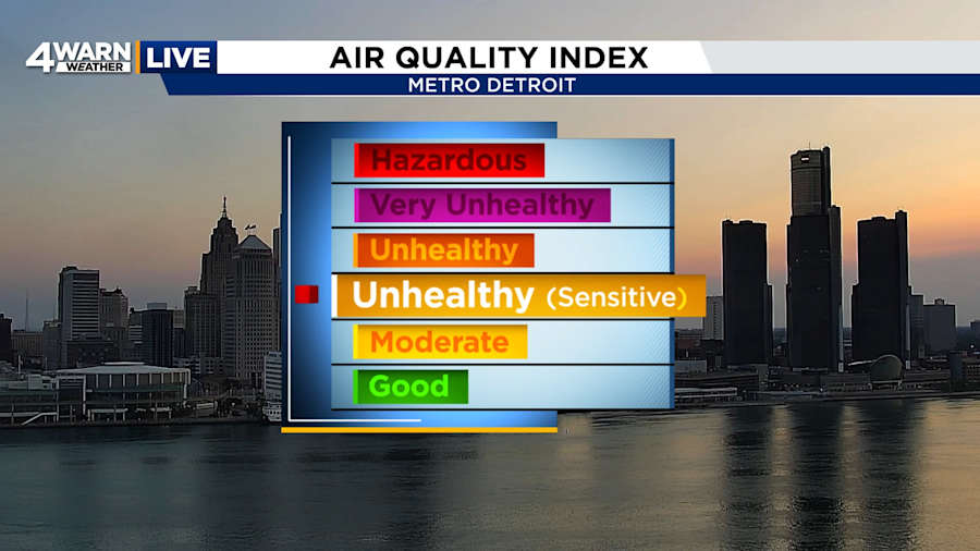
An air quality alert is in effect for most areas along and South of I-69 through the day on Friday. This is due to smoke from Canadian wildfires as well as anticipated smoke from fireworks being set off. So, let’s keep an eye on our friends and neighbors, as well as those that have respiratory diseases like asthma, maybe a little more time inside than outside for the Fourth of July.
High-pressure will control the forecast as we go through the end of the weekend of the start of the weekend, but with enough moisture in stability around thanks to the heat humidity, we will see the chance of one or two thunderstorms late Friday afternoon and into Friday evening. The thunderstorm chances will not be widespread, so I expect most places to stay dry as we had throughout the day.
Summer heat and humidity kicks in throughout the day on Friday as well. Expect high temperatures to head into the upper 80s to near 90°, but once you’ve factor in the humidity, heat index values will head into the low to mid 90s by Friday afternoon.
We will keep the dry weather under the forecast, looking ahead into the start of the weekend on Saturday, lots of sunshine is expected, with a little more cloud cover, rolling in by Saturday afternoon. But it will be hot and humid throughout the day. High temperatures will head into the low 90s by the afternoon, but once you factor in the humidity, expected index values to sore into the upper 90s to near 100°.
Chances for showers and thunderstorms, roll into the region by the end of the weekend on Sunday, especially in the afternoon and evening. We will keep some sunshine in as we start the day on Sunday, but the summer heat humidity will stick around into the end of the weekend. High temperatures heading into the lower 90s, once you factor in the humidity, expect heat index value to soar into the upper 90s to near 100° once again.
Better chances for showers and thunderstorms were under the forecast looking heading into early next week on Monday. High temperatures dropping back into the 80s for the start of next week.
Dry weather sticks around by the time we work into Tuesday, before more chances of rain showers move into the forecast looking ahead into the middle of the week on Wednesday, as well as Thursday. High temperatures remaining seasonable. Expect high temperatures to warm back into the middle 80s by the middle of next week.
FRIDAY: Mostly sunny skies. An isolated thunderstorm or two are possible in the afternoon and evening. High: 89.
FRIDAY NIGHT: Partly cloudy skies. Warm and humid. Low: 70.
SATURDAY: Mostly sunny skies, hot and humid. High: 93.
SATURDAY NIGHT: Mainly clear skies. Low: 73.
SUNDAY: Partly cloudy skies, a chance of showers and thunderstorms in the afternoon & evening. Hot and humid. High: 93.
SUNDAY NIGHT: Partly cloudy skies, a chance of a few showers and thunderstorms. Low: 69.
