
Metro Detroit has sunshine in the forecast, but you may still need to allow extra time for your morning commute.
Chance of foggy morning commute
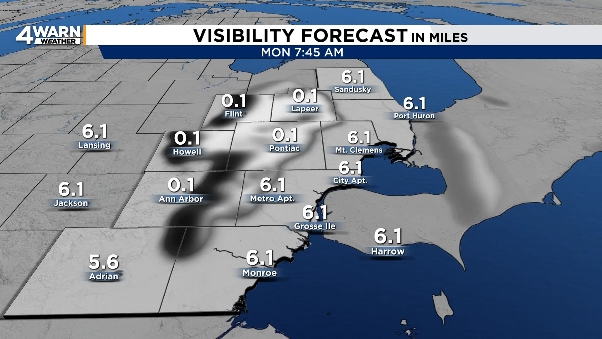
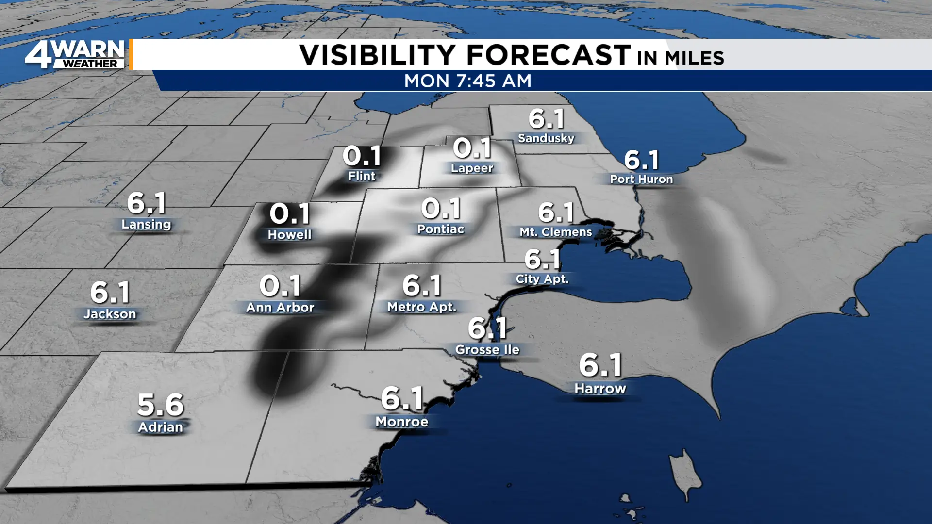
Another round of fog could develop across Southeast Michigan late Sunday night into Monday morning after patchy, and in some places dense, fog developed Sunday morning. Some of the thicker fog could significantly reduce visibility for the early commute, particularly north of Detroit and in areas closer to the Thumb.
If you encounter dense fog, slow down, leave more distance between your vehicle and the one ahead of you and use low-beam headlights and fog lights. Avoid high beams. The brighter light reflects off the tiny water droplets in the fog and can actually make it harder to see.
Once the fog dissipates Monday morning, it should turn into another pleasant September afternoon. Sunshine will become more plentiful with highs generally in the lower to mid-70s. A light jacket may feel comfortable heading out early with temperatures beginning the day mainly in the 40s and 50s, but you probably will not need it for long. Sunglasses will be the more useful accessory by afternoon.
High pressure remains the dominant feature across the Great Lakes through Tuesday, keeping most of Southeast Michigan dry. Monday should be mostly sunny overall, although some clouds on the western edge of the large circulation around the Northeast coastal storm could occasionally drift into the region. Those clouds should not spoil what will otherwise be a fairly bright day.
Fog may make another appearance Monday night into Tuesday morning. Winds become even lighter as high pressure settles almost directly over the area, creating favorable conditions for temperatures to cool toward the dew point. That could allow widespread fog to form in spots before sunshine takes over again Tuesday.
Tuesday will be another mild day, with highs mainly in the lower to mid-70s. Wednesday also appears largely dry and mild, with temperatures reaching the 70s again. There is only a slight chance of a rain shower late.
Late-week rain chances
The pattern begins to change during the second half of the week. Moisture will increase ahead of a frontal system approaching the Great Lakes, bringing a growing chance of rain Thursday into Friday. There is still some uncertainty over exactly how quickly that system moves through, so the precise timing and rainfall amounts may change.
Behind the front, cooler air settles into Southeast Michigan heading into next weekend. The cooldown does not look harsh for early October, but highs could retreat into the 60s Friday through Sunday after several days in the 70s.
Nor’easter slowly loosens its grip
While Southeast Michigan enjoys quieter weather, a powerful nor’easter continues to affect parts of the Northeast and New England.
The coastal storm has produced days of strong winds, heavy rain, rough surf, beach erosion and coastal flooding. The worst of the damaging wind threat is beginning to ease, but windswept rain, localized street flooding and coastal flooding remain concerns into Monday, especially across parts of southern New England.
The storm is gradually lifting toward the Gulf of Maine and should continue weakening as the new workweek begins. Conditions across New England improve substantially by Tuesday.
For Metro Detroit, the nor’easter stays far enough east to keep its rain and wind away. Instead, our bigger concerns to start the week will be the possibility of fog during the morning commutes.
Share your weather photos with Local 4 at MIPics.
