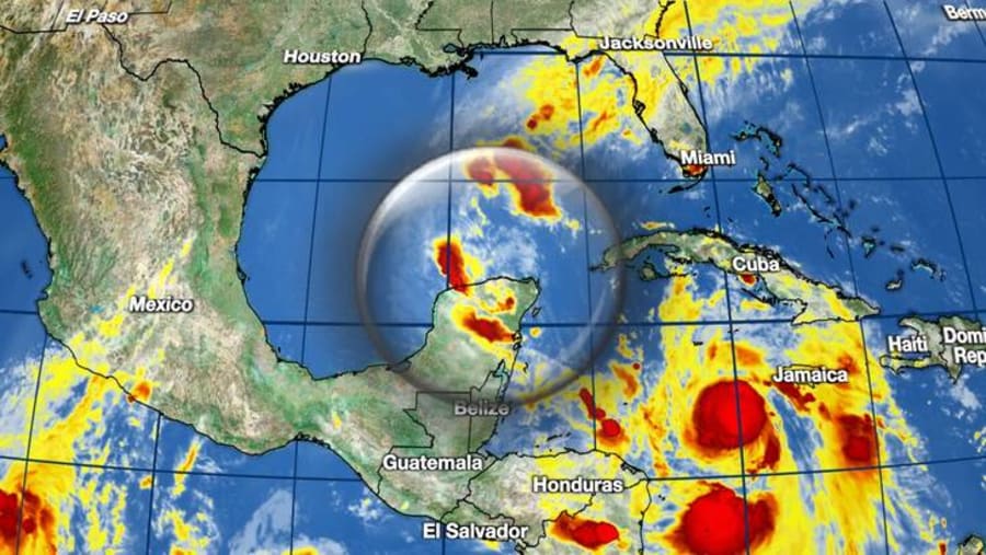
| Location | 85 miles ENE of Progreso Mexico |
| Wind | 35 mph |
| Heading | SW at 6 mph |
| Pressure | 29.68 |
| Coordinates | 88.4W, 21.6N |
Recommended Videos
Discussion
At 1000 PM CDT (0300 UTC), the center of Post-Tropical Cyclone Gamma was located near latitude 21.6 North, longitude 88.4 West. The post-tropical cyclone is moving toward the southwest near 6 mph (9 km/h), and this general motion is expected to continue for the next day or so. The post-tropical cyclone is currently centered along the northern coast of the Yucatan peninsula and will move inland through Monday.
Maximum sustained winds are near 35 mph (55 km/h) with higher gusts. Gradual weakening is anticipated and Gamma is forecast to dissipate by Wednesday.
The estimated minimum central pressure is 1005 mb (29.68 inches).

Watches and Warnings
There are no coastal watches or warnings in effect.

Land Hazards
RAINFALL: Through midweek, the remnants of Gamma are expected to produce an additional 2 to 4 inches of rainfall with isolated maximum amounts of 8 inches across portions of the Mexican states of Yucatan, Campeche, and Tabasco. This rainfall may produce areas of flash flooding.

