Rain returned to the area a couple of hours earlier this afternoon than I thought yesterday. Regardless, the rest of the forecast remains intact in terms of bands of rain increasing tonight, with lows in the mid to upper 50s (14 degrees Celsius). Northeast wind at 5 to 10 mph.
Keep the umbrella handy on Thursday, as it’ll be a wet day. There is some indication that the rain could begin to taper off by late afternoon, so that’s something to hope for. Highs will only reach the mid 60s (19 degrees Celsius), with wind become northwest at 5 to 10 mph. Total rainfall by the end of the day on Thursday could exceed one inch in some areas...especially south of M-59.
Recommended Videos
Cloudy skies prevail Thursday night, with lows in the mid 50s (12 degrees Celsius).
After a cloudy start on Friday, some breaks of sunshine develop during the afternoon. Highs in the low 70s (22 degrees Celsius).
Holiday Weekend:
Saturday
There’s a little good news from today’s computer models. As I explained yesterday, weak little upper air disturbances will trigger periodic rain this weekend, and the models are notoriously bad at the placement and timing of these disturbances until we get a day or two ahead of time. Consequently, the models have had great difficulty tracking the movement of a disturbance passing us on Saturday. Two days ago, it was passing far enough south so that we wouldn’t be impacted. Yesterday, the models brought it significantly farther north, so I had to introduce a rain chance to the Saturday forecast. Today, the models are either bringing it through overnight Friday night, or keeping it farther south again. The upshot is that I’m now reverting back to thinking that we may have a mostly dry day on Saturday. As long as we stay dry, and get some breaks of sun, temperatures should be able to reach the mid to upper 70s (25 degrees Celsius).
Sunday
It still appears that we have a shower chance on Sunday, although I am not expecting it to rain the entire day. I hope that tomorrow’s models give me a better handle on the timing of the disturbance that will trigger Sunday’s showers, so I can help you plan your day. Highs should still reach the mid 70s (24 degrees Celsius).
Memorial Day:
At this point, it still appears that we MIGHT be able to squeeze out some dry hours in the morning for all of the parades around town (if I can pull this off, especially in Farmington where I’ll be co-emceeing the 47th Annual Memorial Day Parade, I’ll be a hero). However, the heroics would end there, as I still feel that some showers will pop up during the afternoon. That certainly won’t help your barbecue plans. Highs in the low 70s (22 degrees Celsius).
Long Range Outlook:
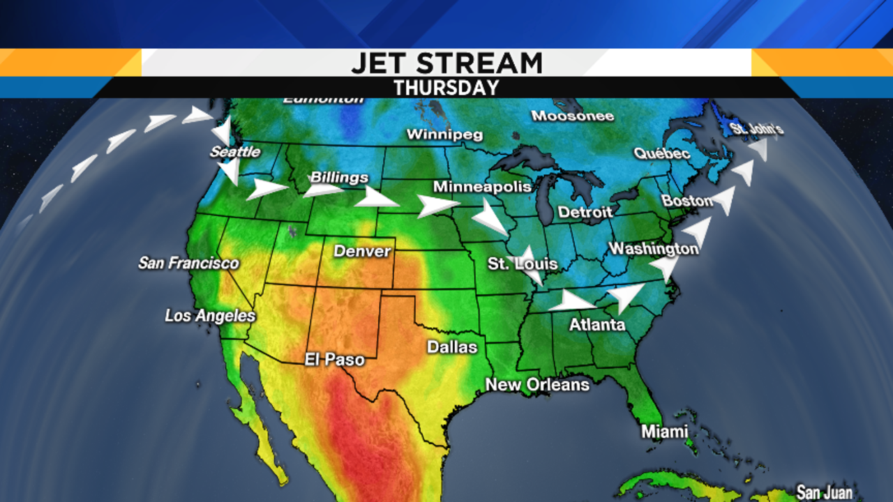
I’ve continued monitoring the long range computer models (these models are called ensembles, as they take a bunch of model runs and create a forecast that’s based upon an average of all of those individual model runs). It still appears that, with the exception of this weekend, we’ll remain mostly in an eastern U.S. trough of low pressure for the next eight days or so, and then finally see the jet stream push north to its normal summer position during the first week of June. Here are some jet stream maps covering the next seven days showing you the persistence of that eastern U.S. dip in the jet stream. But just beyond the range of these maps, things finally change. So hang in there…it’s on the way!