DETROIT – Dual threats of dangerous heat and severe storms will last into the weekend.
Recommended Videos
The storm risk has been upgraded to slight for most of Southeast Michigan. The South Zone is now under a marginal storm risk. The air is extremely unstable, with near-record heat and oppressive humidity.
Damaging winds and intense downpours will be the two main threats we’re watching Friday night. These threats will last through about 10 p.m.
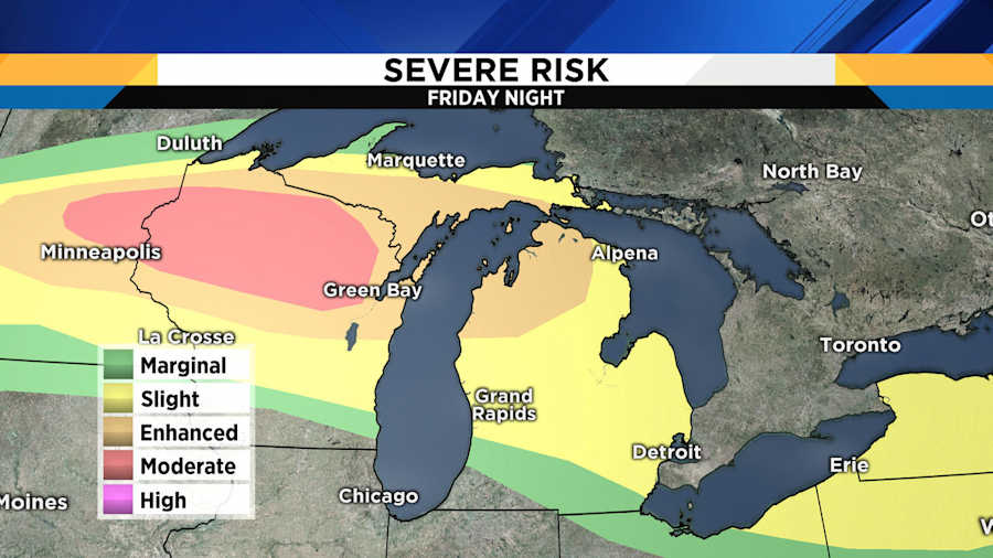
Storms throughout Michigan
There is a larger severe threat in Northern Michigan, and it will arrive overnight. A line of fast-moving damaging winds will race through the Upper Peninsula just before midnight, heading toward northern lower Michigan in the early morning hours of Saturday.
This condition is called derecho, which is from the Spanish word meaning “direct” or “straight ahead," in addition to “right” but that doesn’t apply here. You can see it on radar as a large, bowed line of storms.
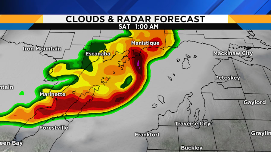
If you have friends or family who are vacationing up north, alert them to the potential threat. These storms will strike after sunset, so make sure they have a way to get weather warnings throughout the night. The line of storms will likely fall apart before it gets to us, but be ready for the possibility of at least an early morning storm in the North Zone.
Excessive heat warning
Even though most of us will escape the storms overnight, we’re on our way to one of the hottest nights in Detroit history. Only three times have lows been at 80 degrees or warmer. Our official forecast is 79 degrees, so it will be a close call.
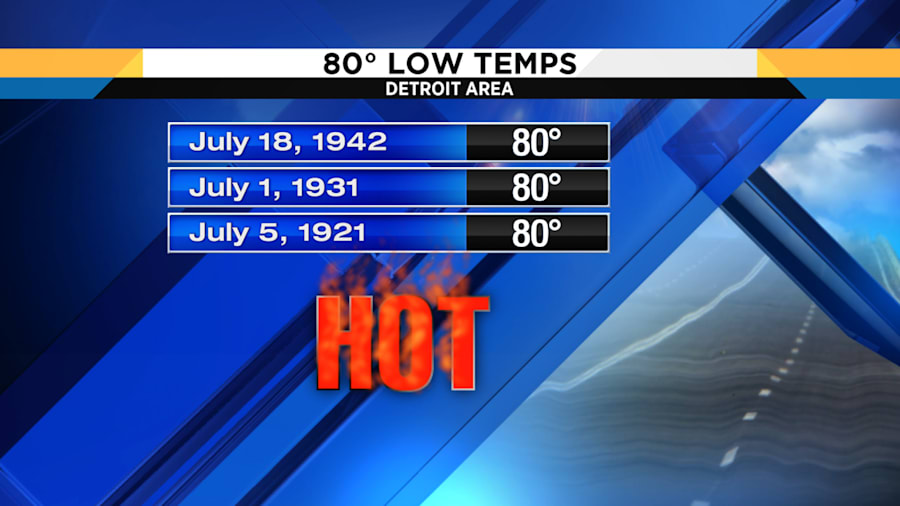
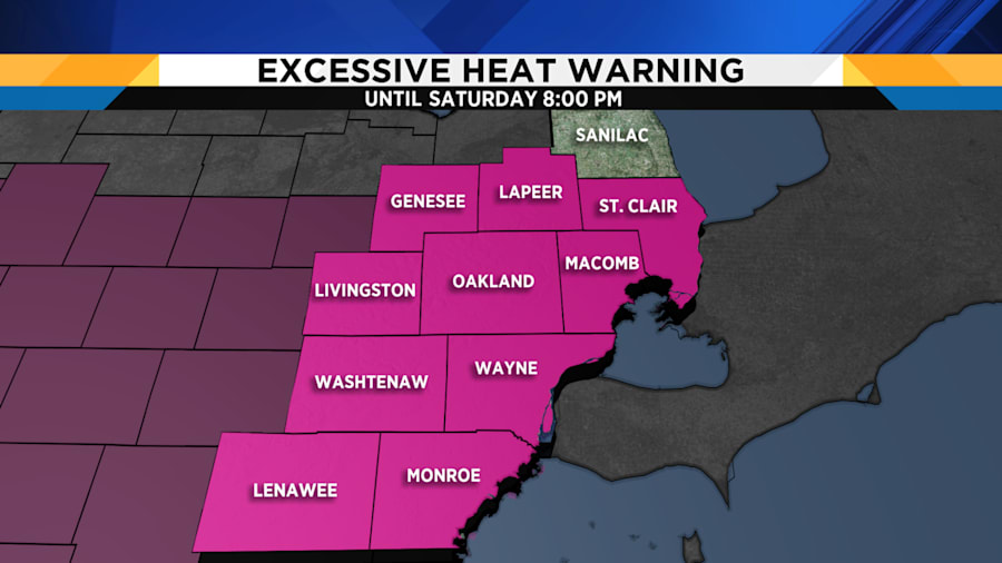
An excessive heat warning will continue for nearly the entire area through Saturday evening. Sanilac County remains under a heat advisory.
We will have to endure one more day of dangerous heat. If you and your family are hydrated and cool, take a minute to check on relatives and neighbors who might have trouble getting through this weather. Cooling centers are open throughout Metro Detroit to provide air conditioning and water.

Weekend forecast
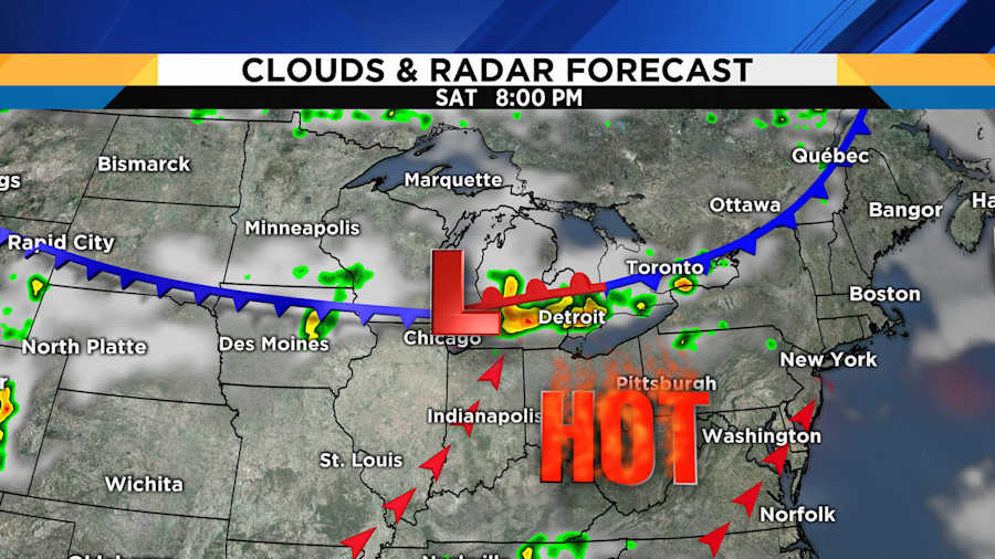
Storms are possible Saturday, too. The severe risk is marginal for most of Metro Detroit, and we’re watching the evening hours as the most likely time for those storms to arrive.
Storms are more likely in the northern half of the area, but everyone should be alert.
Some relief will arrive Sunday as a cold front rolls through, but that really only takes us out of the danger zone. It will still be warm and muggy. Those conditions are unstable enough to keep shower and storm chances around in spots, but they shouldn’t be as widespread.
Cooler and less humid air will pour in Monday. Highs will barely get to 80 degrees with extremely dry air.


