DETROIT – The National Weather Service has confirmed a tornado touched down Thursday night in Michigan's Thumb region.
According to the NWS, the weak EF-0 tornado touched down about 8:10 p.m. in the far southeast corner of Tuscola County. The tornado had a maximum width of about 100 yards and traveled about 3 miles. Its peak wind is estimated to have been about 75 mph, according to the weather service.
Touchdown started at 8:10 p.m. near the village of Kingston and ended about 8:17 p.m. No injuries were reported.
The NWS offered this summary of a preliminary survey of the damage:
Sporadic minor tree and crop damage along a path from Clothier Road between Denhoff and Brief Roads to Northeast of the intersection of Marton Road (Tuscola/Sanilac county line) and Sanilac Road (M46). Greatest observed damage was the removal of roofing material from an outbuilding near the corner of Marton and Sanilac Roads, which is consistent with winds of approximately 75 MPH (EF0). Additional minor tree damage was observed along the damage path.
This video shows the damage:
VIDEO: Possible tornado touches down in Michigan's Thumb region
Twitter user @wx_ryan said his video captured the tornado:
Debris being thrown everywhere from earlier tornado in Tuscola/Sanilac Counties in Michigan. @PGLocal4 @NWSDetroit @ReedTimmerAccu pic.twitter.com/nC0hwHBInx
— Ryan (@wx_ryan) August 18, 2017
Meteorologist Paul Gross explains Thursday's tornado conditions:
If you read my weather article Thursday, you may recall my extensive discussion about the wind shear that would exist during the afternoon.
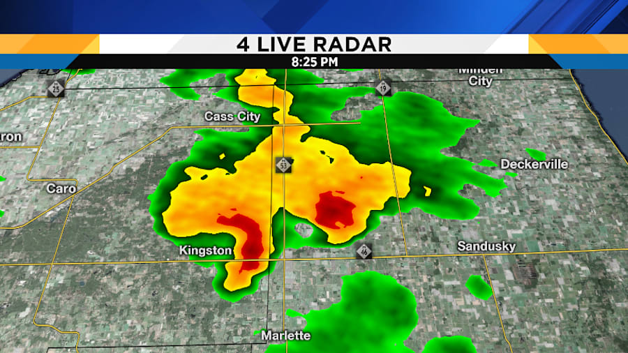
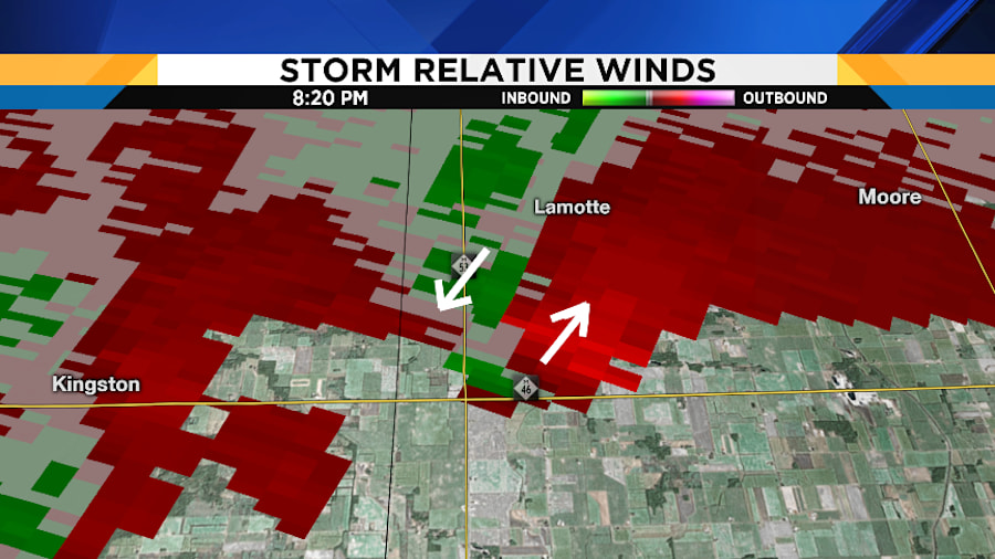
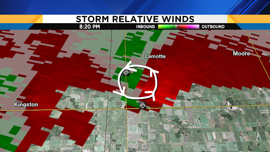
If late-afternoon and evening thunderstorms developed, that wind shear would cause some of those storms to rotate, yielding a tornado potential. However, getting those storms to pop was dependent upon us getting enough late-afternoon sunshine. There was a razor-thin margin of error, and now you can see why: While most of us did not receive a late-day storm, a line of showers did develop across our North Zone -- and it appears that one shower dropped a tornado in Tuscola and Sanilac Counties.
Most remarkable is that there was no lightning with the cell! This shows you how critically important that wind shear was: A heavy shower developed, it wasn’t a storm, and yet there was still an impressive enough wind field to generate a tornado.
The National Weather Service will send out a storm survey team today to study the damage path and confirm if it was indeed a tornado (although video I’ve seen suggests that it was), and determine its statistics.
These radar images show the shower which caused the tornado:


Tuscola County is on the western border of Sanilac County in Michigan's Thumb region.
Sign up for ClickOnDetroit breaking news alerts and email newsletters


